M
aps of Tisbury and Dukes County
1784 Map of Dukes County
(97k)
J. Reid's 1796 Map of Dukes County
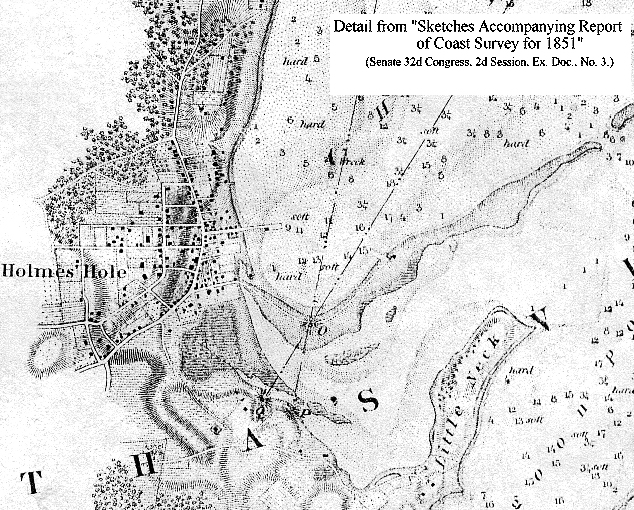
U.S. Navy 1847 Coast Survey of Holmes Hole
(356k)
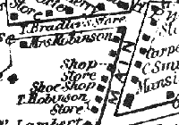
Henry F. Walling's 1858 Map of Holmes Hole
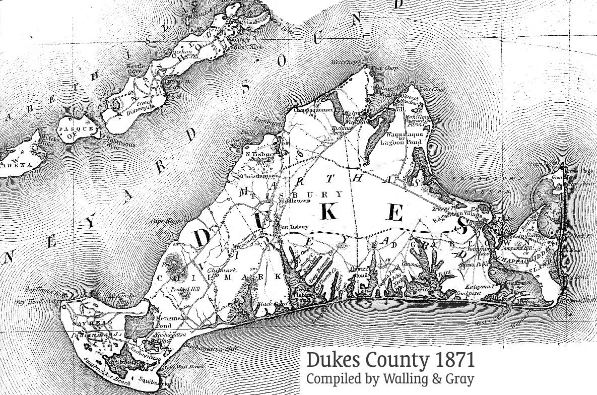
Walling & Gray's 1871 Map of Dukes County
(444k)
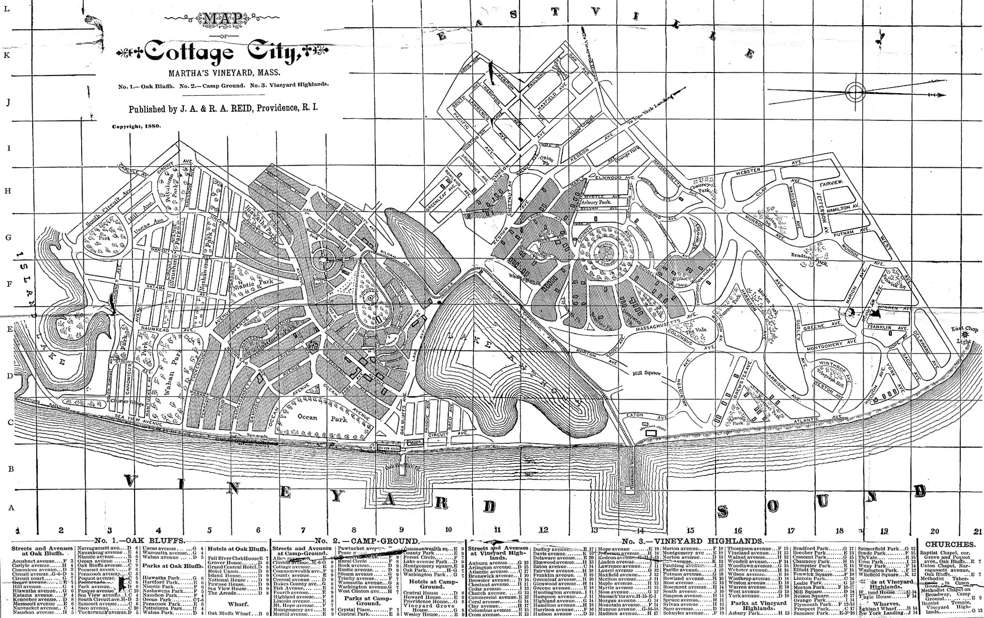
J.A. and R.A. Reid's map of Cottage City, 1880
(737k)
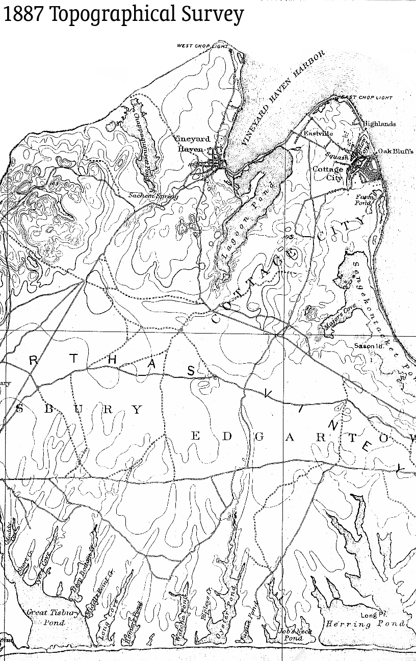
U.S.G.S. 1887 Map
(241k)
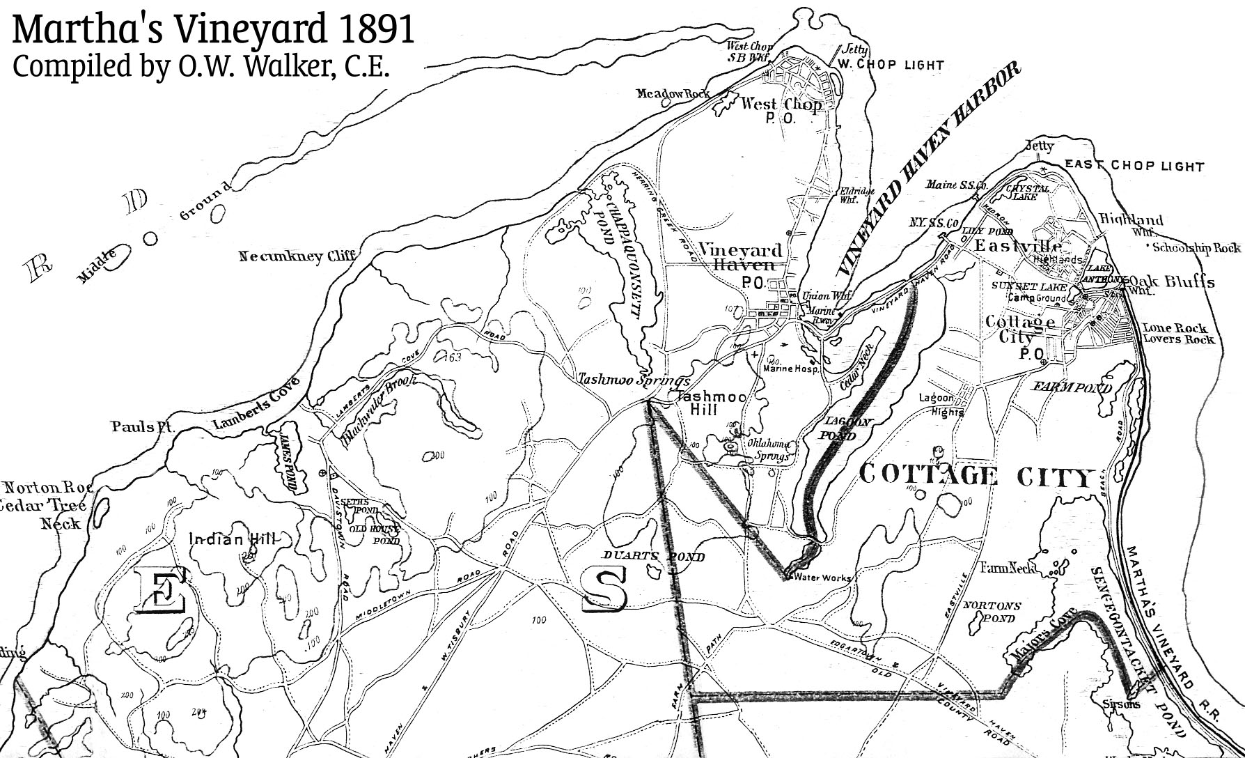
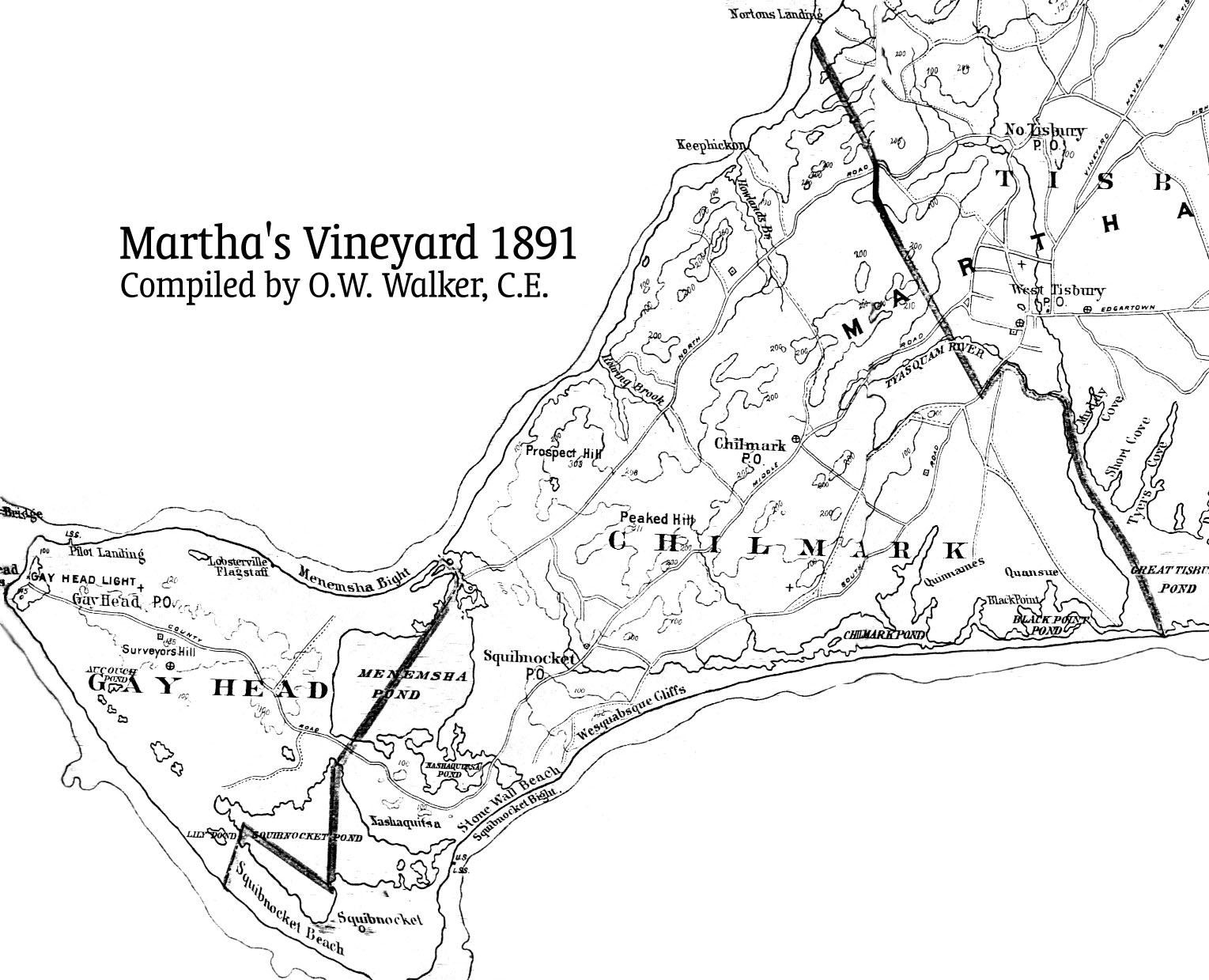
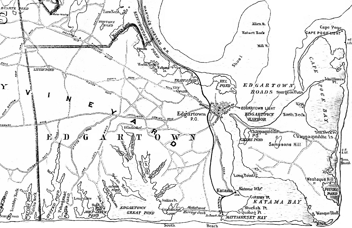
O. W. Walker's 1891 Map of Tisbury
and Cottage City
(400k)
,
Chilmark
(286k)
and Edgartown
(272k)
.
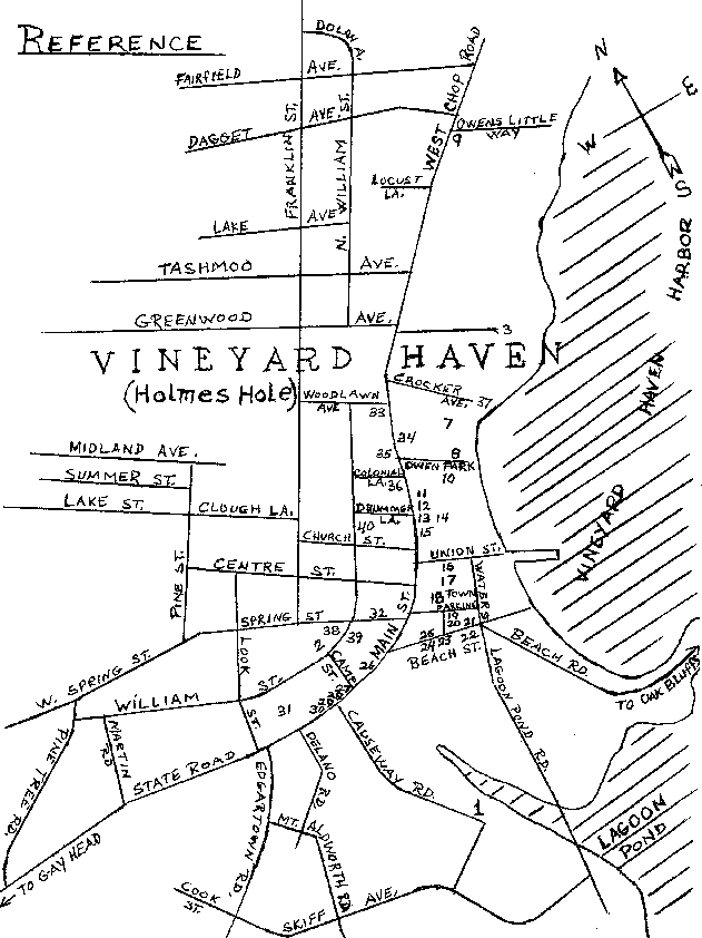
Annotated Dec. 1914
Map of Vineyard Haven
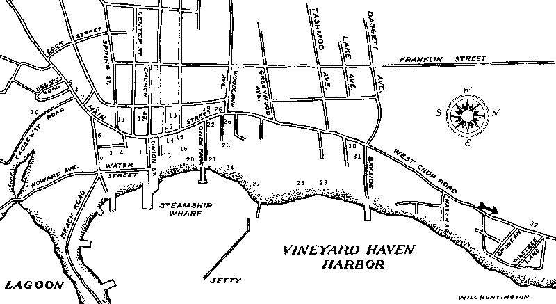
Stan Lair's modern reference sketch
of Vineyard Haven
(See
Sketches of Old Homes
for remarks.)
Tercentenary Committee's
modern map of Vineyard Haven
(See
Old Houses
for remarks.)
Comments? Questions? Corrections? Suggestions? Write the
compiler
.
Back to the
Return to Dukes County History

