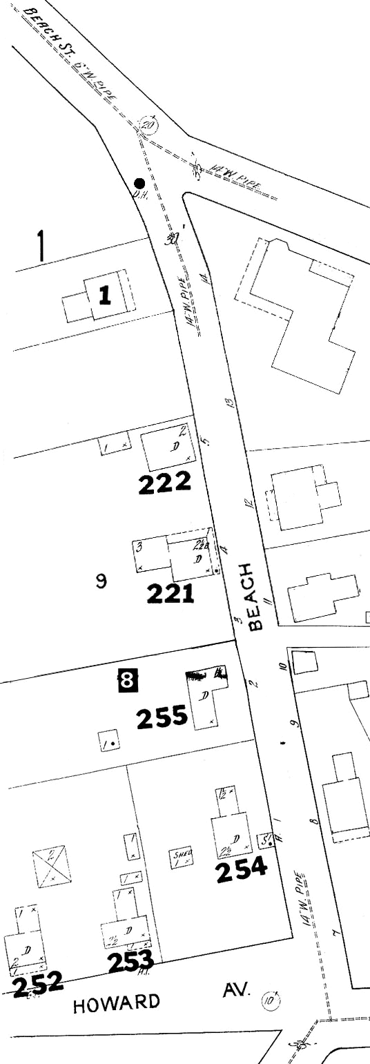
Beach Street, South Main Street, Howard Ave. (Lagoon Pond Road, "Chicken Street")
This map is derived from part of a December 1914 map of Vineyard Haven made by the Sanborn Map Company of New York.
Numbers and KEY added by Stan Lair, c. 1980.
KEY.
Notes in Quotation Marks by Stan Lair, c. 1980.
1. "Elizabeth Peakes (Burleigh House) (Harry Peakes mother)"
221. "Clement L. Cleveland -- Fisherman - Razed for new Fire Station."
[1907 Directory: "Cleveland, Clement L., fisherman, h. Beach."]222. "Susan Allen -- Arthur Stewart ---- Razed for new Fire Station."
[1907 Directory: "Allen, Susan, widow Truman, h. Beach."]252. "Joseph Dugan -- Moved to Duarte Village."
[1907 Directory: "Dugan, Joseph E., fisherman, h. Howard Ave., n. Beach."]253. "Mrs. White ---- Moved to Duarte Village."
254. "The Lucy Cooper House (razed) Cumberland Farms Store now at this spot."
"What was called the Nye House - an old lady by the name of Lucy Cooper lived there for awhile, I think it was called the Cooper House at one time. The roof blew off of that house in a hurricane, and the house was torn down. It was located about where the present U.S. Post Office Building is."255. "Prentis Bodfish House ---- Blacksmith."
[1907 Directory: "Bodfish, Prentiss C., blacksmith, Beach, h. do."]
Do you have any memories or photographs of these homes and businesses that you would like to share? Email me!
Return to Section #4.
Return to 1914 Tisbury Maps.
Return to Tisbury Records.